Geologic Map of Oregon
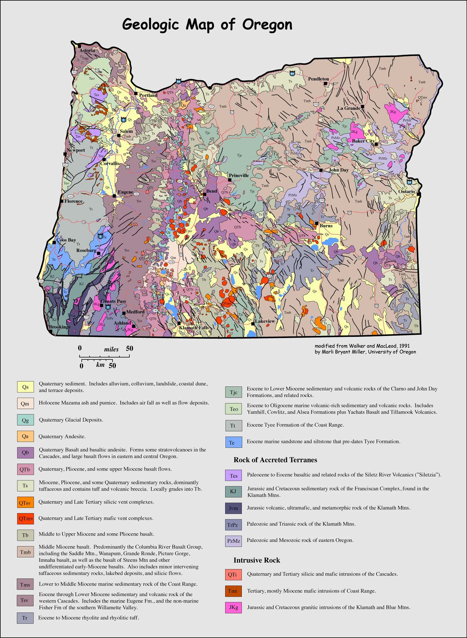
Oregon displays an amazing variety of fascinating geology, from its accreted terranes on the southern coast and in the Blue Mountains area to its Miocene age Columbia River flood basalt to its active volcanism in the Cascade Range. This map, simplified by Marli Miller from the 1991 Oregon State Geologic Map, also shows major highways --and prints out nicely as a course or field trip handout. Enjoy!
You can download the map at full size by just dragging this to your desktop.
Click here to go to Geology Pictures
Click here for Geologic Maps of National Parks
For photos of Oregon? Go to the geology photo search page and type in "Oregon"!
Click here for homepage