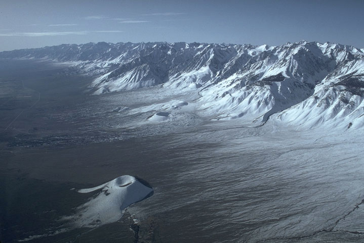
The Sierra Nevada rises along a series of normal and strike-slip faults in the Owens Valley of California to mark the eastern edge of the Sierra Nevada. This fault last slipped during the M7.4 Owens Valley Earthquake of 1872. Note the cinder cone--several recent basaltic lava flows have erupted along the trace of the fault. Click here for a photo of the fault scarp of the 1872 Owens Valley earthquake.
|
Aerial view of the western edge of the Basin and Range.
Back to Aerial photos of the Basin and Range.
On to Aerial view of Mono Lake and Sierra Nevada.
Back to Aerial view of the Wasatch Mountains, the east edge of the Basin and Range.
to Geology Images
Geology Photos Homepage