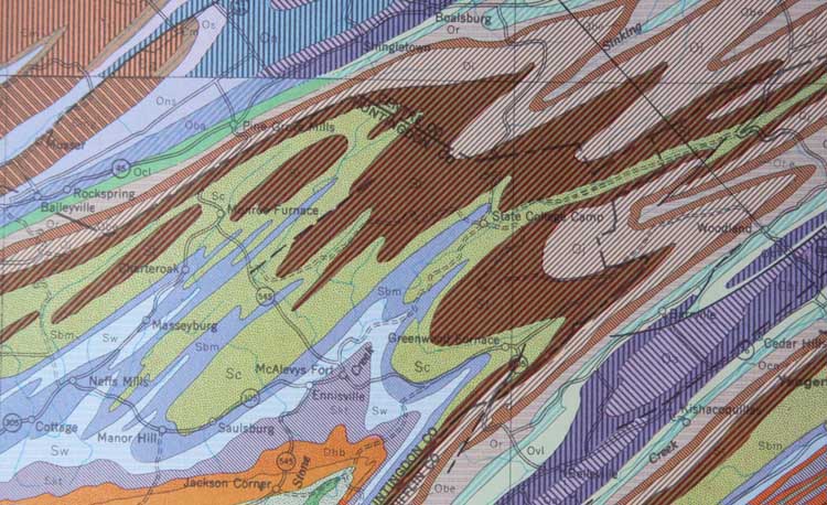
This map depicts folded Paleozoic rocks in Pennsylvania...just east of State College. It measures about 30 km across. You can tell that the folds plunge to the southwest by figuring out which are the anticlines and synclines --and remembering that with anticlines, folds plunge in the same direction as the nose, and with synclines, they plunge in the direction that the limbs open up. You can tell which folds are the anticlines and which are the synclines by remembering that anticlines have the oldest rock in their cores whereas synclines have the youngest rock there...The brown-shaded units in this map are generally Ordovician, the greens and blues are Silurian, and the orange is Devonian.