Lake Abert
In contrast to Crater Lake, Lake Abert, in the Basin and Range of southern Oregon, is incredibly shallow, with an average depth of only about 7 feet. Lake Abert has no outlet --and as a result of the high evaporation rates, the water is extremely alkaline. As fish can't live in the alkaline water, innumerable brine shrimp do --which makes the lake an important destination for migratory birds. Lake Abert, and Summer Lake to the east, are the remaining two lakes after the much more extensive Pleistocene Lake Chewaucan dried up.
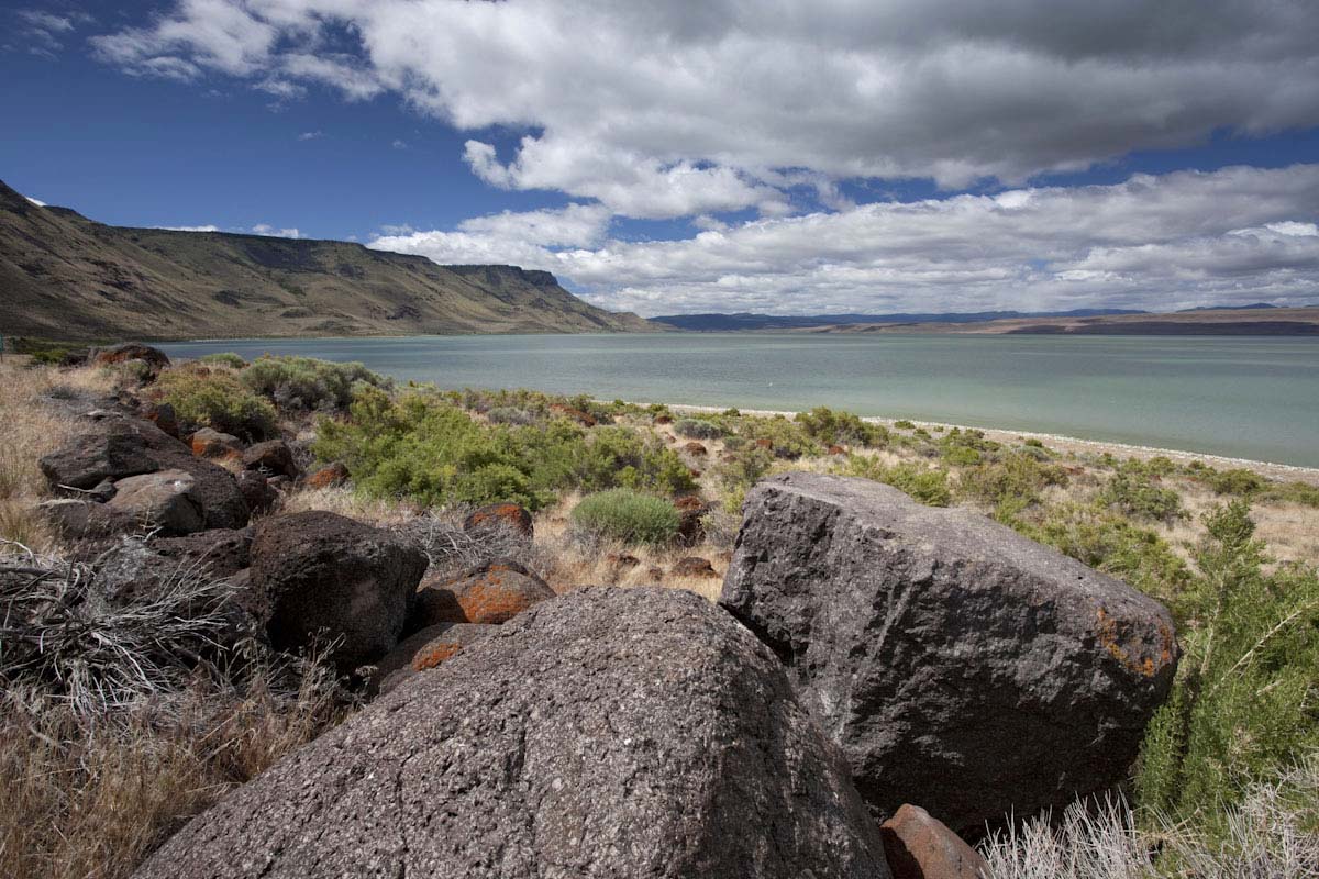
This photo, looking south, shows Abert Rim, the high ridge that borders the lake. Abert Rim has been uplifted along a normal fault that is a reflection of the crustal extension in the region that is ongoing today. Abert Rim is composed chiefly of the rock in the foreground, a very distinctive flow of Steens Basalt, an early phase of the Columbia River Basalt Group. I took this photo with my friend Birgitta as we passed through while working on the Roadside Geology of Oregon book.
|
See some aerial photos of the Basin and Range Province of California, Oregon, Nevada, and Utah.
Pictures of the Columbia River Basalt Group in northern Oregon.
Return to the "favorites" page.
Return to photography home page.
Go to the next photo, Summit of Spencer Butte near Eugene.