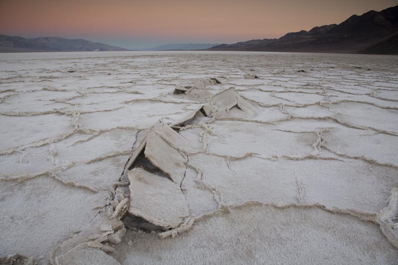
Death Valley Salt Pan at sunrise, January 1, 2008
The salt flats of Death Valley, called the "salt pan", stretch more than 10 miles in a north-south direction and a good 5 miles across. They actually mark the terminus of a river --the Amargosa River, which starts up near Ash Meadows in neighboring Nevada. Since there is no outlet, the water tends to accumulate in Death Valley until it evaporates, which typically happens pretty quickly. The salt pan does flood occasionally. I've once seen people kayaking on the very-ephemeral lake! As the water evaporates, it leaves behind salt, which you can see here, broken into large shrinkage polygons.
I got up early for this photo --it was New Year's Day, 2008 --and I was staying at SHEAR (Shoshone Education and Research) in Shoshone. It was cold --when I passed through Death Valley junction, the temperature read 18°F. Of course it was warmer on the floor of Death Valley, which is nearly 300 feet below sea level --probably 30°F! But it was silent --and beautiful.
|
See more images of Death Valley --then type "Death Valley ".
View of slideshow of 20 Death Valley geology photos.
Geologic Map of Death Valley.
Return to the "favorites" page.
Return to photography home page
Go onto the next photo, Aerial View of Puget Sound, Washington